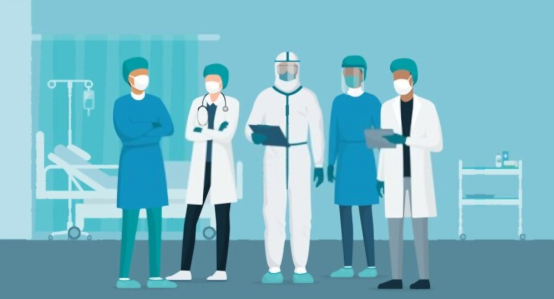
Health Workers Shadow of memory
When the epidemic traces are still evident, it is not far to think about cities with Health Workers. Health with society, and society with the concern of today’s trials. Until the next Pandemic, will we remember how interconnected our lives are, but only when we are interlocking can we look to the future? Based on the epidemic, is it possible for us to remember the city’s memory, the memory of the place, through design? What can measure the balance between the vital importance of forgetting to maintain life and the natural reflexes that remembering requires to survive?
How can we remember when we forget? How should we forget when we place? The project seeks answers to these questions, perhaps cannot find.
To this end, he presents a three-stage narrative: Urban Narrative, Spatial Narrative, Garden of Memory, and Its Components.
-
URBAN NARRATIVE
While evaluating the project’s scope, it is impossible to ignore the location, historical position, and traces of the area in the city. In this sense, the Epidemic and Health history; We tried to read the city in parallel Health Workers. With its Ecology and Hydrology infrastructure, interpret Istanbul by looking at it again in four frames: Macro, Medium, Micro, and Nano. This analysis-based narrative with four frames descending from the scale of the city to the scale of the Earth. It also forms the basis of all the structural elements proposed at the scale of the Memorial. In this way, he wishes to intensify the connectivity of the space, albeit to some extent, with the traces of the city’s memory.
1.1 Hydrology as Infrastructure/ Beyale Waterline (Macro Scale)
The topography of Istanbul and the city’s relationship with Water have been the determinants of settlement decisions throughout history. The waterways carried over the topography ridges, and the water structures that provide distribution can be noticed by following their traces in the city. The project area coincides with the Beyale waterline of the city’s hydrological infrastructure. Takis Maksim was an institution in 1732 for water distribution in line with the needs created by urbanization. In addition to this feature. It has performed a critical role in providing hygiene in the epidemics of the past years. The spirit level next to the project area was also building in the 1730s to transmit Water. When looking at the site from the urban scale, ‘Traces of Water’ is quite prominent of landscape drawing.
1.2 Transportation as Infrastructure (Macro Scale)
Istanbul’s transportation infrastructure and settlement decisions follow its water infrastructure, health workers. The points where the Water can reach, the access points to the water form. The basis of all this seemingly irregular order. Considering these inseparable historical infrastructure elements, it is no coincidence that Beyale is locating at the center and intersection of all connections in the city. Topography water determines water settlement decisions. Transportation also follows.
1.3 Ecology-Hydrology Relationship (Medium Scale)
The city carries ecological richness and potential. The environmental importance of Gezi Park and Macca Park, which are parts of a whole today, for Beyale is base on this geographical position. When viewed from a macro scale, the location of the project area between Macca and Gezi serves as an ecological link. However, it has been dividing from history to the present.
The strong bond of Ecology and Hydrology in the region strengthens our decision to use Water as a unifying trace in transforming the project area into a Remembrance of Epidemics and Health Workers as ecological conjunction.
1.4 The Sunken Tombs of Istanbul (Medium Scale)
This area, including the project area, started to be used as a cemetery after the Great Plague. Epidemic in Istanbul in the 1560s when Suleiman the Magnificent was allocated to the Armenians. As a favor to the cook who saved him from death. Later, this abandoned cemetery area was transferred to the municipality, and the Herbie land cemetery was removed. Considering the site in terms of Health and Epidemics history, the cemetery memory of the region is the primary and most important data for the project area. Just as the tombstones here are used on Gezi Park’s steps, cemeteries are a part of our society, even though they are not visible today.
1.5 Health Network in the Region (Medium Scale)
In the past years, Takis and its surroundings, one of the few settlements of the city. Throughout history, the most cosmopolitan and innovative region has had many different health structures from the Past to the present. This health network from the Past to the present is the most prominent remnant of the field’s health memory. Health infrastructure and cemetery relationship – just like the ecology-hydrology relationship, they are intertwined. The disappearance of one leaves a trace on the other. This invisible relationship of the different layers of memory strengthens the ‘Tracking Traces’ approach in transforming the project area into a memorial.
1.6 Interventions from the Past to the Present (Microscale)
As Park No. 2 in the Prost plans, the boundaries of the region, which was a large inner-city green area until recently, have changed due to the interventions. The region was fragmented, and its borders were divided from 1934 to 1999 due to the effect of the construction.
1.7 Atlas of Healing
The project area is one where the healing from nature finds itself on the city scale. It is base on the healing properties of the tree species existing in the area. Accordingly, a “healing atlas” was created by grouping the plant species in the project area according to their areas of use in pharmacology. The healing atlas is under five headings, not only according to the spatial relationship. But also according to the effect of plants on the human body. Healing atlas has been decisive in herbal design decisions.
Visit for more articles